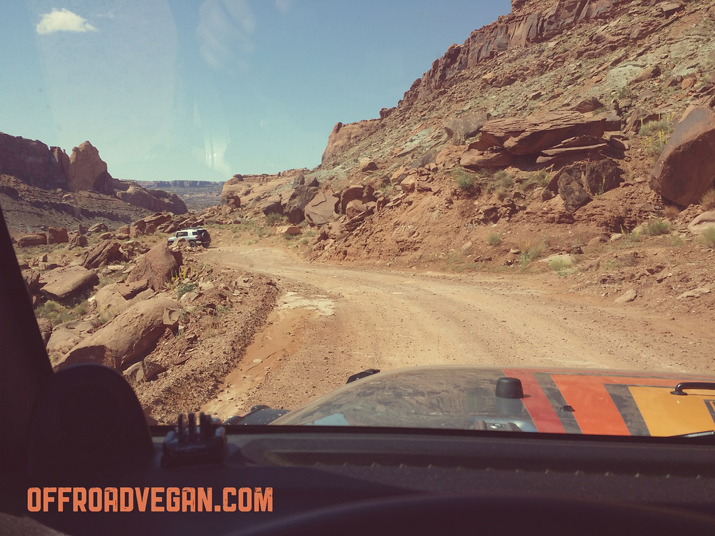
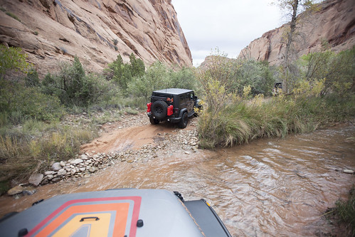
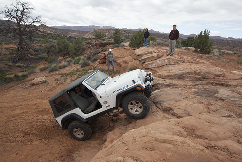
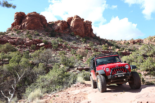
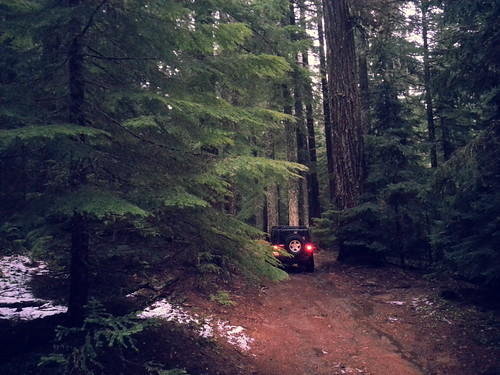
Kane Creek Canyon is a trail that was highly recommended to us by a neighbor when staying at Canyonlands Campground in Moab.
“The only hard part is the climb out of the canyon, and that isn’t too bad” were the only words of hesitation.
So with reckless abandon, I hit the trail with friends Andy, Matt and Joe.
The trail follows Kane Creek Canyon road out of Moab, heading West. The road quickly turns to dirt and descends through a really nice canyon. The road was pretty dusty, so Matt in his JK had to drop back a bit.
Kane Creek starts out a little on the boring side. At least the scenery is amazing.
Eventually the trail appeared on the Left, across from the Kane Creek/Chicken Corners pull off.
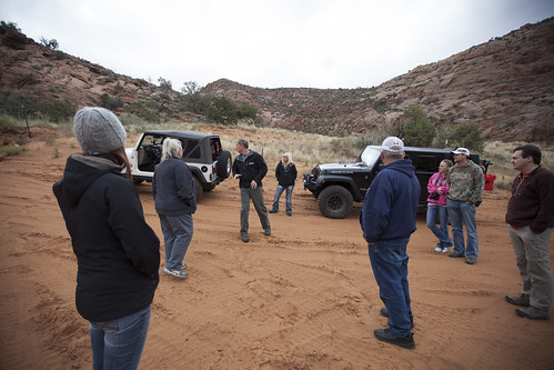
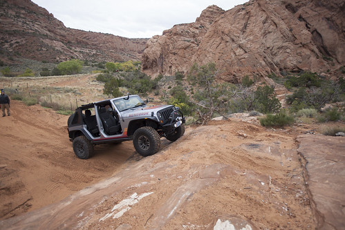
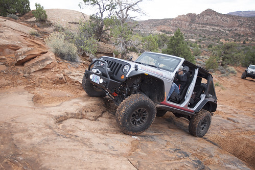
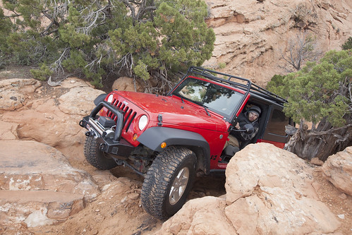
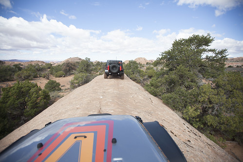
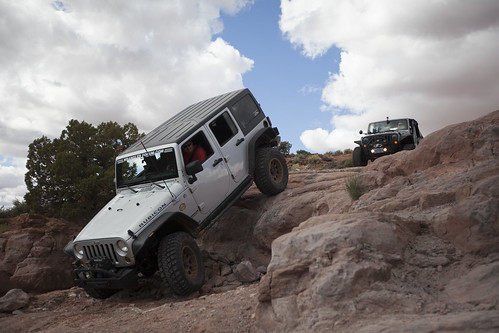
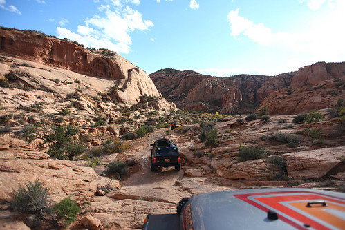
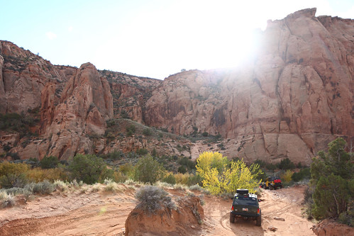
It has been a while since I have been Jeeping in Moab, so I didn’t miss a beat when selecting trails for today. By the end of the day, Andy and I will have run three of Moab’s most iconic trails: Gold Bar Rim, Golden Spike, and (most of) Poison Spider. This review covers the first trail: Gold Bar Rim.
The day started with a brisk temp and a stiff wind which kept temperatures pretty mild even though the sun was beating down on us all day.
Gemini Bridges road leading up out of Moab. Click to enlarge.
Heading ten miles North out of Moab, we turned onto the road for Gemini Bridges. This shelf road quickly climbs for some sweet views below. Eventually it levels off in a pretty wide canyon with some nice campsites peppered throughout.
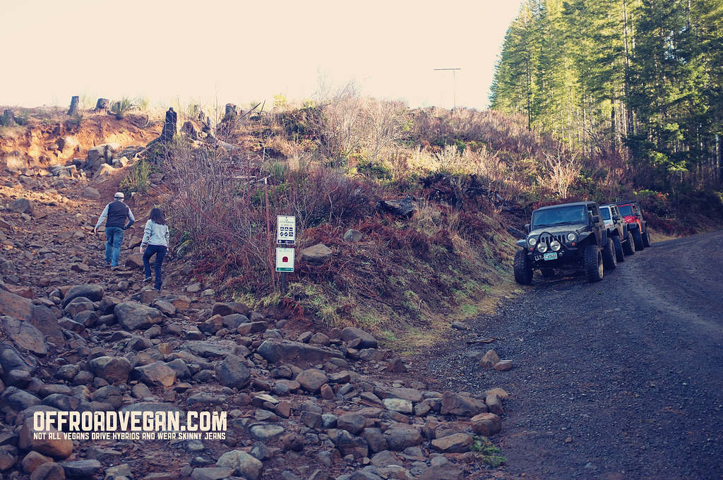
It is not every day you get to pull into an Off Road Vehicle area for the first time. But this morning, we did just that as we decided to visit the Cline Buttes Recreation Area, sandwiched between Redmond and Sisters, Oregon on Rt. 126.
Checking out the maps at the trailhead.
Central Oregon’s drier weather is a welcome change to the recent rain we have been having, and the sandy surfaces of Cline Butte was a nice contrast to the mud at Tillamook State Forest.
Cline Butte was a VERY well organized, and well signed area with plenty of amenities. Forest Management at TSF could learn a thing or two about how to properly run (and sign, and map, etc) an ORV area. We did not get lost once, due in large part to the awesome maps and very well signed network of trails.
The trails are meticulously marked.
After airing down, Jesse, Chris, Melanie and I chatted at Barr North staging area to decide what areas to hit. We warmed up in the open play area (which ended up a giant dump pit full of spent shells, glass, burned wood, etc) and quickly left, making our way to trail 34 – the most difficult trail in the park.
Warming up on some ledges.
We decided to warm up on a couple of ledges on the outer rim of the open play area. With Chris’ expert spotting, both Jesse and I made it up some of the more technical spots.
Then we moved onto trail #34.
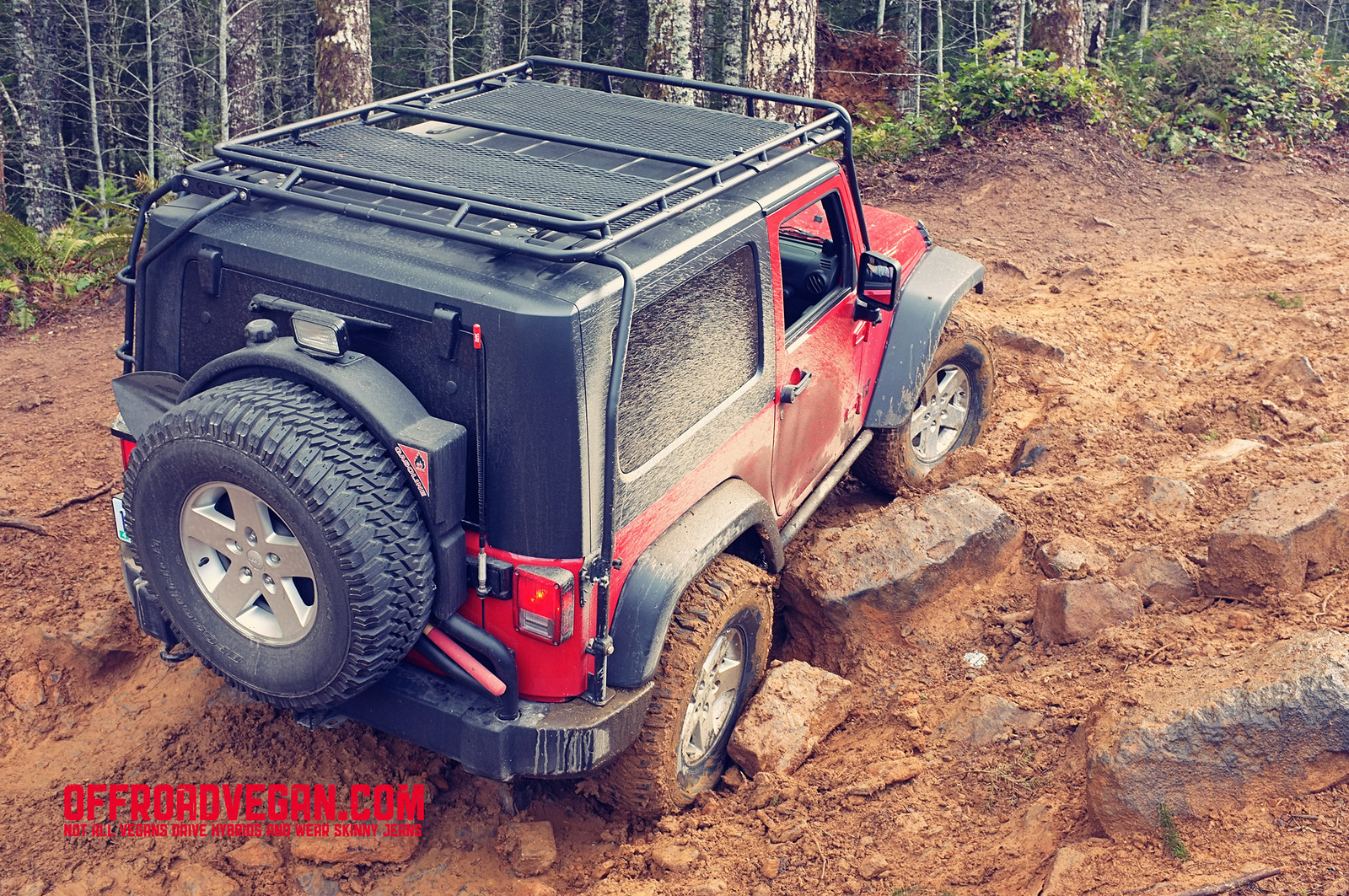
The nice part about this trail is that the difficulty seems to progress as you get further into the trail. The beginning sections are a bit boring, but soon you are encountering more ledges, loose rocks, and challenging terrain.
Trail 34 gets progressively harder.
The sun came out and we broke for lunch about half way into the trail. Lunch was Tofurky sandwiches, Earth Balance popcorn and gatorades.
Melanie making sandwiches for lunch.
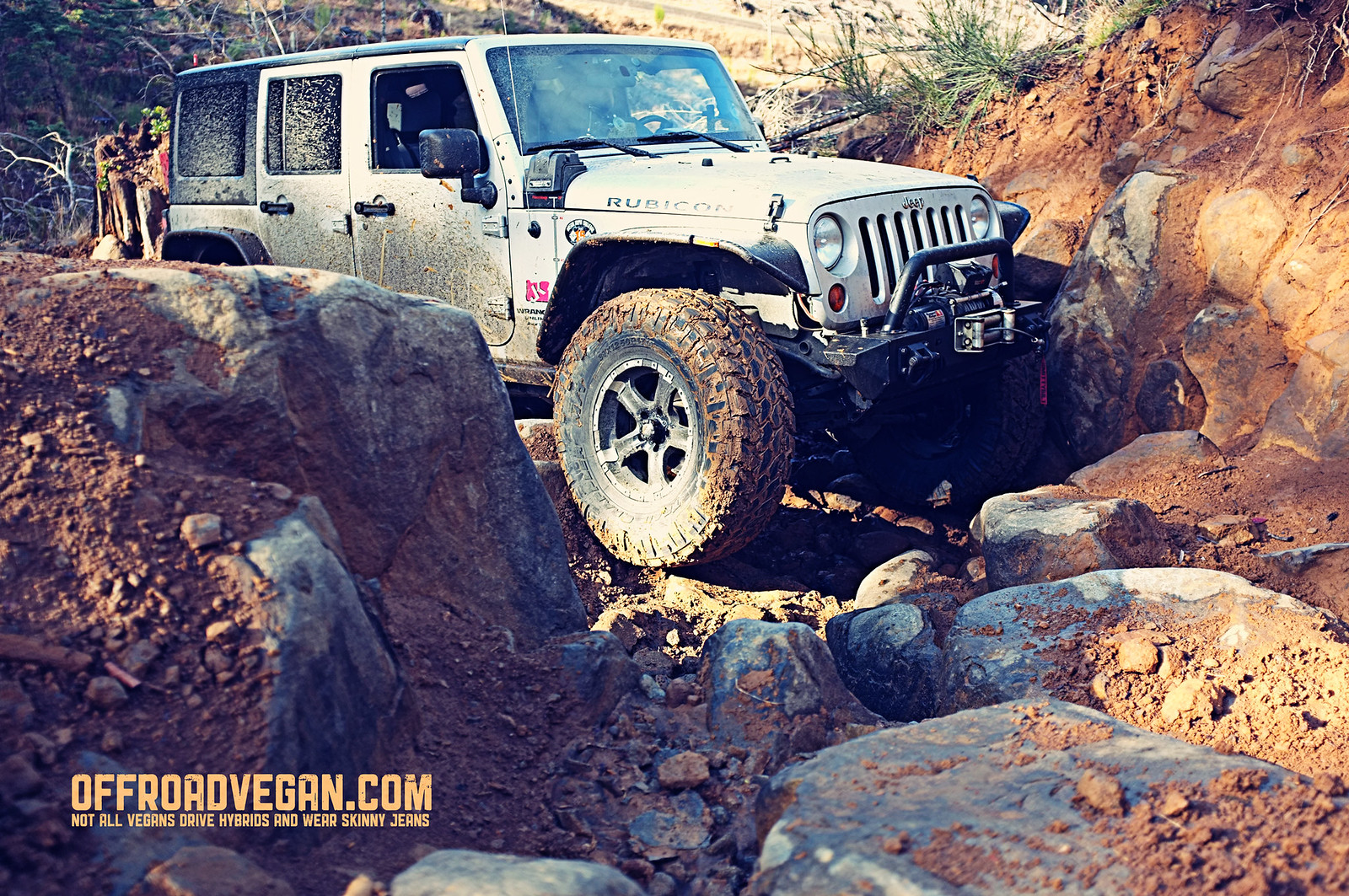
After our break, the wheeling became really rocky. Many obstacles had multiple options and bypasses.
One of the many drops.
Toward the end of the trail is a large ledge on the right side of the trail. There is an obvious route up the ledge between two harder options (the easy option is the one with the small pine tree in the center).
The challenging ledge. Click to enlarge.
If we had more time, I would have attempted the more difficult option on this ledge, to the right of the option pictured above. To the left of above is the most (triple black IMO) difficult option which is probably not doable by very many Jeeps.
About a half mile after the ledge above, we met up with trail #37 which took us straight to the parking area to air up and cruise out.
Overall, Cline Butte was a great change of scenery from TSF. We were not really challenged to the max, but there were some spots that tested our skills. Unfortunately, this was the toughest trail here, so next time will be the same, or some of the simpler trails.
It looks like camping is permitted in the staging area.
Of all the trails sprawled throughout Tillamook State Forest, Cedar Tree is one of my favorites. No, it is not as technical or advanced as Firebreak Five, or as perilous as Airplane Hill or Can Opener. But for a scenic trail that winds through beautiful forest with just enough challenge to keep you guessing, it is the best.
Quick fill up and snacks at Chevron.
As with most Jeeping trips, our day began relatively early, meeting up with our buddy Rob at the North Plains Chevron station. I swear these small businesses survive on the dollars brought in from all these pre-TSF offroad trips. Continue reading Trail Report: Cedar Tree [Oregon]→
I always get excited the night before a big Jeep day. I meticulously pack all my recovery gear, load up the ARB with my vegan goodies, check under the Jeep, check the fluids, and try my best to get some sleep.
As I lay there in bed, I think about what the next day will hold – will I break anything? Will anyone do something awesome (i.e. will they break anything?) Will we all have an awesome time?
The answer to the latter is always a resounding yes. And this day was no different.
My morning began by speaking into this lovely box. On the other end? A Soy latte!
I departed Rhododendron early, in time for a mandatory coffee stop and to pick up some veganaise at Fred’s. Once on the road, I made my way to our typical meeting place in North Plains. I arrived about 30 minutes early.
We pulled into Brown’s Camp to air down and plan our route. I was always interested in Little Rubicon (I mean, I did ‘Big Rubicon’ how hard can this one be?) so we headed off in that direction.
The early morning sun had not yet warmed the rocks of the Little Rubicon. Click to enlarge.
We all decided to walk the hardest part of the trail, choose our lines, and determine who would be the crazy one to go first. As Robert had the best rig for the job, we decided that he would be the guinea pig.
Jeff, claiming the best spotter’s spot. Click to enlarge.
After climbing the initial trail segment, Robert soon hit some of the famous TSF mud. Even his well-equipped JK with Tera Grapplers could not tame the mud, and we all decided it was in his (and his Jeeps’) best interest if we save this trail for another day.
Robert navigating the Little Rubicon. Click to enlarge.
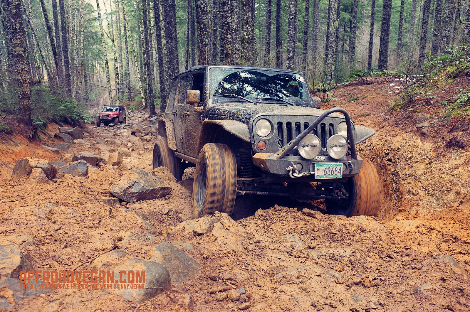
After a regroup, we decided it was time to hit the famous Firebreak 5, similar in it’s intimidation to the Vonnegut namesake, yet lacking the intellectual depth. Nevertheless, we were off to sling some mud, do some good ol’ American cursing, and eat some Beyond Meat.
The lower sections of Firebreak Five. Click to enlarge.
The initial segments of FB5 were fun yet uneventful. At this point, the early morning clouds were burning off and the sun was filtering through TSF’s majestic pines. Of all the things I love about Jeeping in this forest, the smells are my favorite (and no, not just the burning rubber). Sadly, I was amazed at the timber harvest along this famous trail – it was unrecognizable.
GoPro Still: The rocky sections of FB5.
We stopped for a quick lunch break, and I busted out the Beyond Meat, giving everyone a try. My trailing buddies also got free Beyond Meat coupons and recipes to make their own goodies at home.
Vegan goodies on the trail!
After lunch we continued up the hill.
The one spot that we all struggled with (even Robert spun his tires once, I think) was a short muddy section with just enough of a mud/rock ratio that we needed to winch. Robert was the only one in our group to make it on his own.
Jesse hung up on the muddy rocks. Click to enlarge.Even Jeff with his 37 M/Ts struggled in the slop. Click to enlarge.
We all (except Robert) got stuck and needed to be strapped and winched. And, before my friends blame me for not putting photos of my own recovery, well I was driving…
GoPro Still: Jeff getting tugged by Robert.
Once past this section there were a couple of small hang ups but for the most part we made our way along.
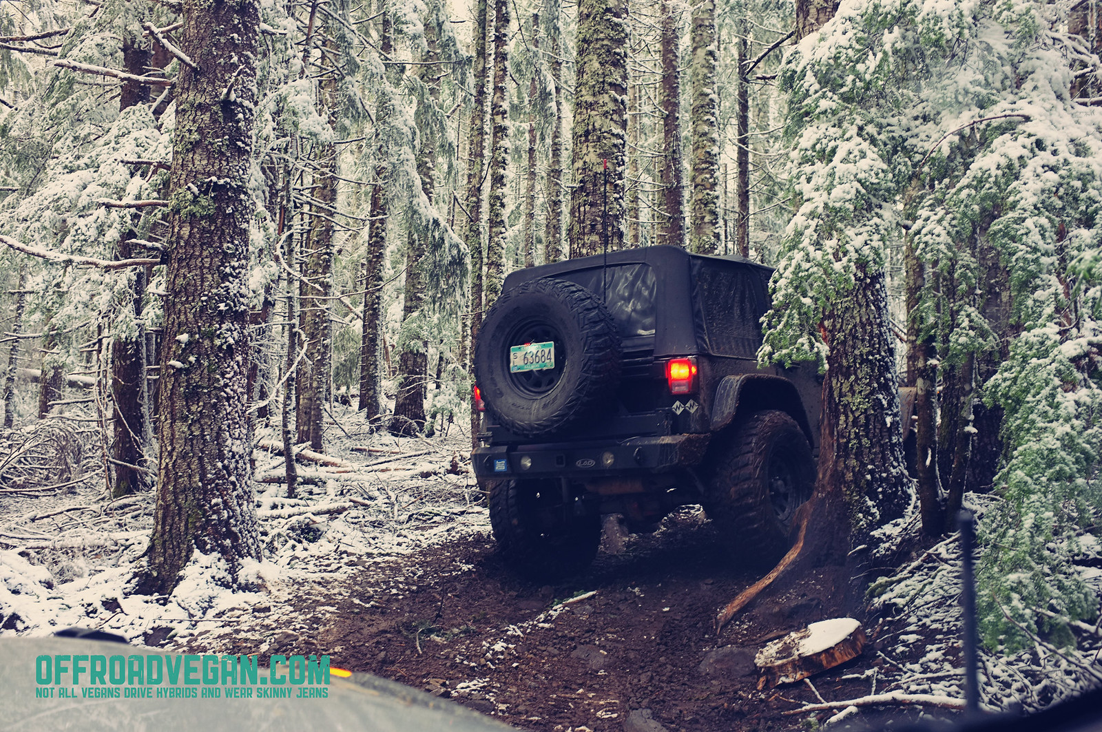
The final section saw us punching through the snowline for a nice change in scenery. The white forest was a stark contrast to the brown, mucky slop we had been fighting with.
Jeff navigating the tight trees on upper FB5. Click to enlarge.
The forest changed her challenge for us in this upper section, from mud to tight, narrow trees. These trees threatened to take off mirrors, fenders, and door handles, and could really make a mess of a nice JK hard top.
We all made it through this gauntlet without issue and soon popped out into a beautiful sunny opening that signaled the end of our day in TSF.
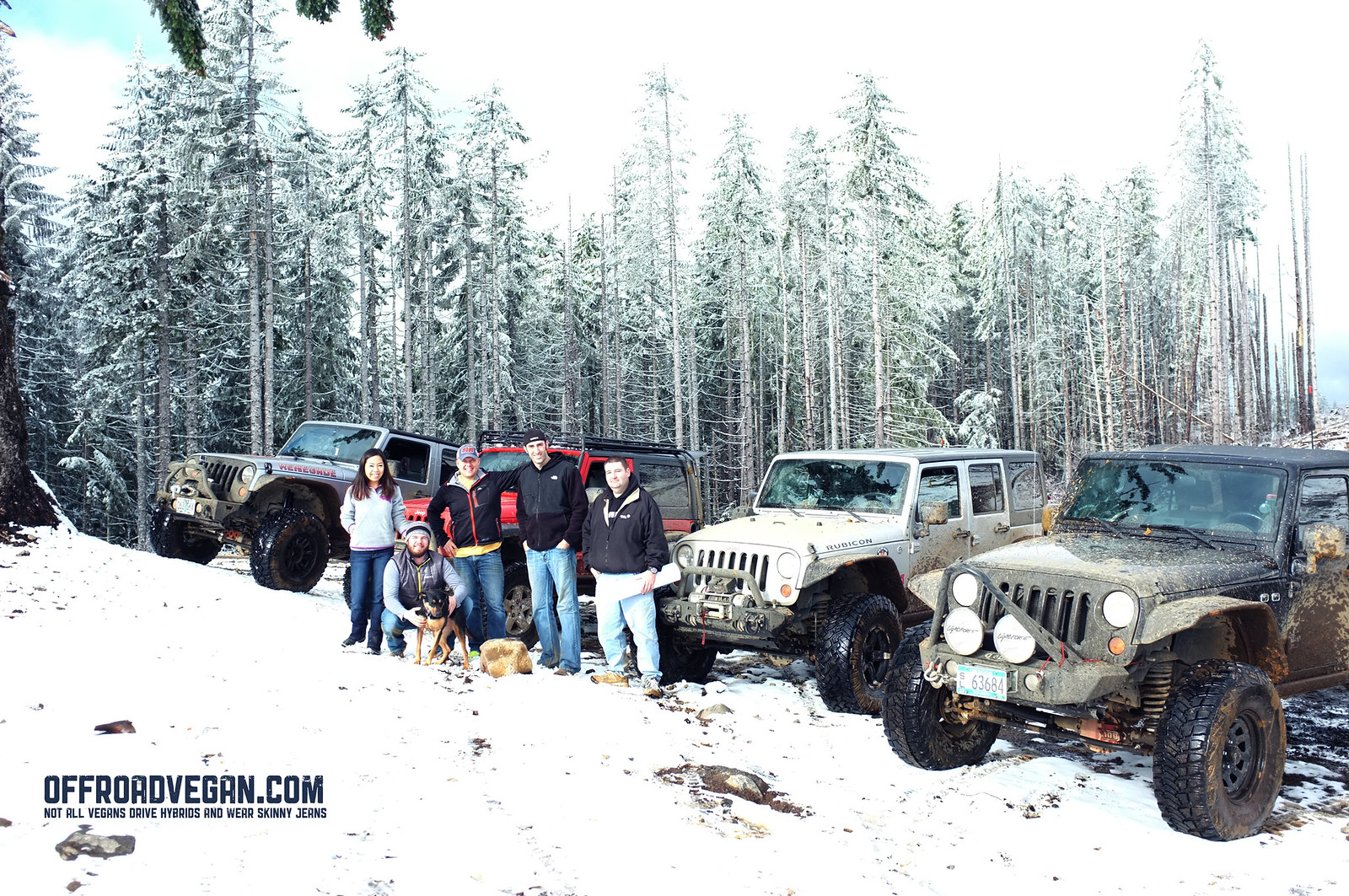
The required group photo at the top of Firebreak Five. Click to enlarge.
My day ended where most days should end – in front of a Buffalo Bomber wrap (with mac, of course) at Veggie Grill!
Frank, parked at Veggie Grill.
I struggled mostly in the mud on this trip, so most of my recommendations would focus on ways to get me the traction I needed in the slop.
This trail was on my Moab Bucket List™ for a long time. A few of the climbs look pretty crazy, the views amazing, and conquering the famed “Hell’s Gate” was one of the reasons I came to Moab.
The sign at the trailhead for Hell’s Revenge. Click it for the high res version if you want to read it.
After a quick air down at the parking lot of Hell’s Revenge Jesse, Melanie and I were on the trail by 8:30.
The trail climbs almost instantly right from the staging area. In the first few minutes, you climb up onto a saddle, riding a narrow ridge – this is just a sample of what’s to come. At the base of this, is a narrow sandy area called “Lake Michigan” due to the potential for high water. It was wet on this day, but easily crossable.
The first ridge you will cross is immediately out of the parking lot.
The views open up into some pretty spectacular scenery. The trail is predominantly on slickrock with some sandy spots. The first couple of climbs will certainly get your heart rate going, especially when you see them in the distance – they look almost vertical. With a little throttle control and some alertness, it is fine. Continue reading Trail Report: Hell’s Revenge [Utah]→
One of my favorite aspects of running trails in Moab is that you can (usually) leave the doors off. Our jeep did not see doors the entire week.
But, this morning was a 6AM departure and a pretty long drive along the Colorado River. It was freezing. Some of the most beautiful scenery I have experienced in a long time. But freezing.
Route 128 follows the Colorado River for most of it’s length.The morning light was amazing off the canyon walls.
We started out pretty early, arriving at the trailhead about 8:00AM.
Quick group photo. Yours truly is taking the picture.
The team posed for a quick photo at the trailhead and we met up with a couple that asked if they could run the trail with us in their Cherokee.
We drove in about 2 miles of pretty easy gravel road with a minor creek crossing, and took a break for a quick driver’s meeting. This was also a great opportunity to meet our new friends.
Minor creek crossing.Quick driver’s meeting.
The area we stopped at was a “Driver’s Choice” section with many different lines of attack. I chose what I thought was a challenging ledge and was able to get up reasonably easy, even though the rock surface had some damp sand.
My challenging line.
The trail continued to have a series of ledges and stairs peppered throughout its length.
Me trying to get Frank up a slick ledge.
Eventually, the trail opened up with a long ledge essentially splitting the trail into an upper and lower section. Mark led the pack up through a narrow “V” which seemed to be the best line, with the least potential for tippyness.
Mark leading the charge.
After this section, the trail turns to the left and climbs up for some elevation gain. There is a great spot for pictures on the ledge above.
From this section on, we navigated some different ledges and couple of tight sections.
Jesse navigating a tight spot. That’s what SHE said!
The trail also opened up and followed a very narrow ridgeline of slickrock. Any missteps here would be a rollover.
The narrow ridgeline.
We broke for a quick lunch spot when the trail settled down and opened up, to allow for others to pass us as needed.
After lunch, we made our way toward the fabled “Fall.” The Fall is a 6-7 foot near vertical drop. At the base of this drop, the driver must turn an immediate left, as there is a ravine to the right. Maintaining full control of the vehicle is critical, especially since once gravity takes over, it will slide down the face of the Fall with little control.
Richard taking on the Fall, with Frank the Tank on his 6.
After the Fall was behind us, we were able to appreciate the scenery of the area. The desert floor opened up to some amazing vistas and rock formations.
Jesse posing.Desert scenery.
At this point, the trail began to descend back to the creek drainage we crossed earlier in the day.
The ground became more sand than rock and presented more tree growth which added to the scenery.
The creek drainage scenery.
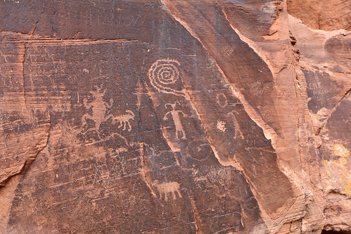
Once over the creek, we decided to check out some ancient petroglyphs/hieroglyphs on a wall. The natural and human history of this area amazes me.
Native art scene.
Once on the road, we stopped at a local pub on our way home for a cold, malted beverage.
Day 2 of our recent “Wheeling Extravaganza” had us headed to the Mt. Hood Wilderness to run the first section of Barlow Road.
This road is of significant historical value, as it part of the original Oregon Trail, and where landowners would setup toll booths to collect tolls from folks headed further West.
We aired down from the parking lot and were surprised to see about six inches of snow on the ground. We started rolling about 3:00 PM.
Airing down in the parking lot. Is that an old 90s R&B track?Initial descent.
The first section had quite a bit of snow, and it was a pretty good descent into the first valley. As we progressed, the snow became thinner and thinner, eventually disappearing completely.
This is not really a Jeep trail per se, but I bet a car could get hung up in some spots if the driver was not careful.
Some of the water crossings were also very deep, so I am glad we left the Fiesta at home.
The snow all but disappeared at lower elevations.
Really cool mileposts lead the way and provide more historical relevancy as you make your way along the trail.
Old milepost.
We ended up pulling over and doing some shooting for about 30 minutes.
To be back home by dark, we turned off after the first section and made our way back to 26.
This trail has some amazing camping sites and I am really looking forward to coming back this Summer.
The team met at the typical location – the Chevron station in North Plains around 9:00.
We were on the road by 9:30.
Arriving at the pull out to air down, we quickly let the air out and got on our way.
Getting to the start of Archer’s Fire Break is always long and boring, but the hill shortly after the trail begins is sure to get the grease moving in the gearbox. This first climb through dense green forest and loose, gravelly mud is just a preview of what is to come.
Shortly after the first climb, the group found ourselves conquering an old foe – the “V Notch.” This long, steady climb also has a very angled stance with the passenger often looking at the ground as it passes by. The driver tries not to lose momentum even with their eyes closed. The extreme angle seems like your Jeep is going to tip over at any moment.
Jeff tackling the top of the “V Notch.”
The rest of the trail is actually a bit on the boring side. It is a series of small segments that continually intersect with the main forest road.
Many of these segments are just long enough where you can get out of 4WL (or simply be in 6th gear at 4,000 RPMs) only to quickly have to re-engage. Many of these trail segments also are pretty featureless, save for a few deep water fordings in the wet months, or some short rock gardens.
Jesse coming down one of the rock gardens along Archer’s Fire Break.
The real coup de gras waits at the end of the trail like a predator stalking its bored and tired prey. The final stretch of this trail is called “Rocky Uphill” for, creatively, both the large number of rocks that litter the path and the fact is in quite uphill.
There are two possible routes starting from the base of RH – the right and left – with the left side being rumored as the easier side. On this trip however, they both seemed equally scaled.
The two options soon merge near the top, where the pitch of the hill steepens, the rocks increase in size, and the driver is again presented with two options: right or left.
Right seemed to be the easier choice. The left side has seen vehicles roll over on previous days (granted it was a Toyota).
After Rocky Uphill, the trail continues with one last technical section, then meets up with the forest road for the drive back to air up and head home.
![Trail Review: Kane Creek Canyon [UTAH]](https://offroadvegan.com/wp-content/uploads/2014/05/20140516_181539.jpg?w=672&h=372&crop=1)

![Trail Review: Gold Bar Rim [UTAH]](https://offroadvegan.com/wp-content/uploads/2014/05/cover.jpg?w=672&h=372&crop=1)
![Trail Report: Cline Butte Trail #34 [Oregon]](https://offroadvegan.com/wp-content/uploads/2014/04/feat2.jpg?w=672&h=372&crop=1)


![Trail Report: Cedar Tree [Oregon]](https://offroadvegan.com/wp-content/uploads/2014/04/2014-03-29-13-18-53.jpg?w=672&h=372&crop=1)

![Trail Day: Tillamook State Forest [Oregon]](https://offroadvegan.com/wp-content/uploads/2014/02/dscf3324.jpg?w=672&h=372&crop=1)


![Trail Report: Hell’s Revenge [Utah]](https://offroadvegan.com/wp-content/uploads/2013/12/img_8998.jpg?w=672&h=372&crop=1)


![Trail Report: Onion Creek Canyon & Rose Garden Hill [UTAH]](https://offroadvegan.com/wp-content/uploads/2013/12/img_8834.jpg?w=672&h=372&crop=1)


![Trail Report: Steelbender [Utah]](https://offroadvegan.com/wp-content/uploads/2013/11/img_8394.jpg?w=672&h=372&crop=1)
![Trail Report: Barlow Trail [Oregon]](https://offroadvegan.com/wp-content/uploads/2013/11/2013-12-03-01-08-50-1.jpg?w=672&h=372&crop=1)


![Trail Report: Archer’s Firebreak [Oregon]](https://offroadvegan.com/wp-content/uploads/2013/11/2013-11-16-11-59-59.jpg?w=672&h=372&crop=1)


